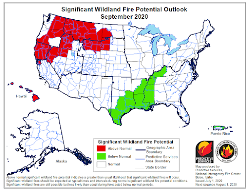
Well we've made it pretty far into the summer with no large incidents yet, though many across the state have seen some haze creeping in. While there were a few starts in Southern Idaho last week in brush and grass, they were contained quickly. California, on the other hand has had some pretty big fire growth in the last week with several fires in Northern California totaling a little under 50,000 acres, burning in brush, grass, and timber. Oregon ,Washington, Utah, and Nevada have all seen a few fires but nothing like California yet.
You can see on this screenshot from
AirNow that the air quality monitors are almost all Green (which is Good) and that the majority of the smoke is being carried over to us from California, though there could be some impacts from Oregon, Utah, and Nevada also. Keep checking your favorite
air quality/smoke incident websites for details and stay safe!
Airnow.gov - June 27, 2020 0930 MDT


